The National Weather Service issued multiple tornado warnings and watches across several U.S. states this week due to powerful storm systems [1, 2, 3].
These alerts signal a high-risk period for residents in the Midwest, Southeast, and Northeast. The convergence of a strong storm system and the remnants of Tropical Storm Arthur has created volatile atmospheric conditions capable of producing damaging winds and large hail [2, 4, 5].
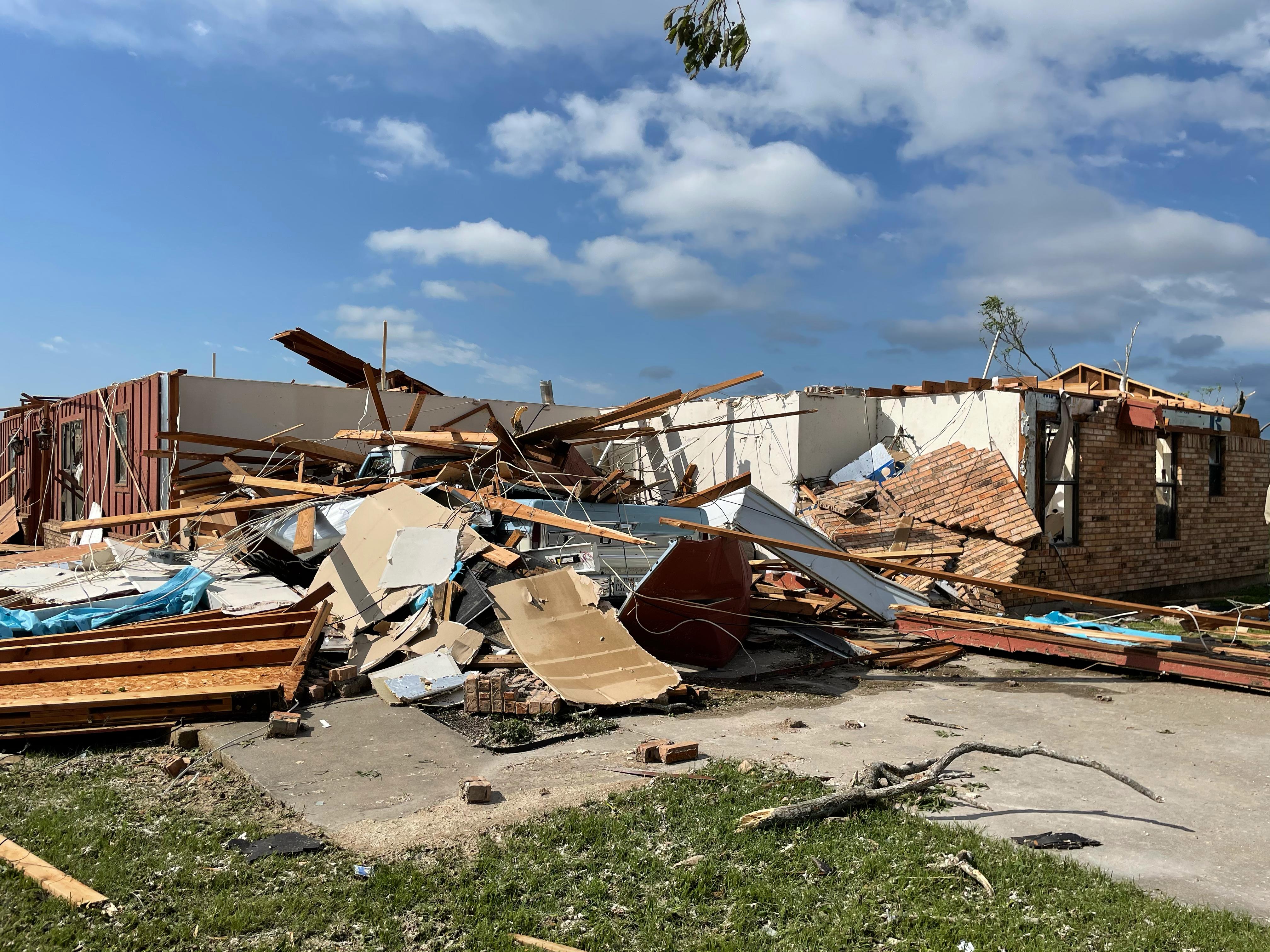
In Texas, the agency issued a tornado warning for Parker and Palo Pinto counties at 4:23 a.m. [1] on Friday. That specific warning remained in effect until 5:15 a.m. [1]. These early morning alerts forced residents to seek immediate shelter as the weather system tracked through the region.
The instability extended to the Midwest on June 17, 2026 [2]. The Storm Prediction Center warned of strong storms and damaging winds affecting states including Illinois and Iowa [2]. These regions faced significant threats from a system moving across the heart of the country [2, 4].
Further east, New York faced similar threats on Thursday. The National Weather Service issued a tornado watch at 9:58 a.m. [3], which remained valid until 3 p.m. [3]. This watch covered four counties in the North Country region: Clinton, Essex, Franklin, and St. Lawrence [3].
Additional alerts were noted in Pensacola, Florida, and parts of the Southeast [3, 4]. The remnants of Tropical Storm Arthur contributed to the instability, pushing moisture and energy into the interior of the U.S. [4]. This combination of tropical remnants and continental storm fronts often increases the likelihood of severe rotation and sudden tornado formation [5].
Local authorities in the affected counties advised residents to monitor weather radios and maintain emergency kits. The National Weather Service said the system continues to evolve as it moves across the landscape [1, 2].
“The National Weather Service issued multiple tornado warnings and watches across several U.S. states this week.”
The simultaneous occurrence of a traditional mid-latitude storm system and the remnants of a tropical storm creates a 'compound event' that increases weather volatility. When tropical moisture interacts with cold fronts in the Midwest and Northeast, it often results in more frequent and intense tornadic activity than a single system would produce alone, necessitating coordinated alerts across disparate geographic regions.


