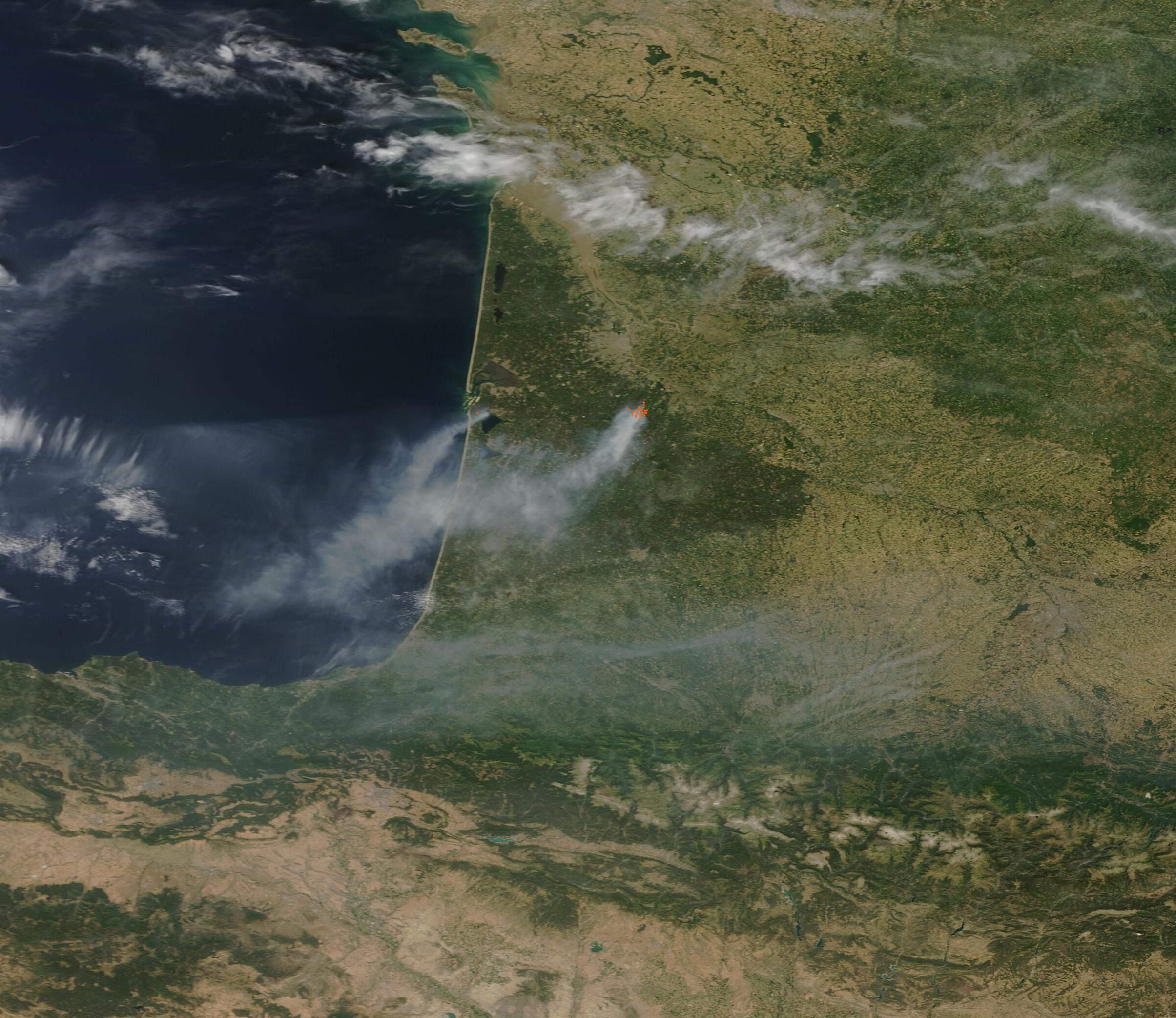
French firefighters and volunteer crews are containing the final hot spots of a massive wildfire that swept through southwestern France on Friday, July 26 [1, 3].
The scale of the destruction highlights the increasing vulnerability of the Atlantic coast to extreme weather. The blaze occurred during a period of intense heat and low humidity, creating conditions that allowed the fire to spread rapidly through the Gironde department near Bordeaux [2, 5].
Officials said the fire burned approximately 42,000 hectares, which is about 162 square miles [1]. This area is roughly four times the size of Paris [1]. To combat the flames, authorities mobilized 2,500 firefighters and deployed 18 planes and helicopters [4].
The emergency response included the evacuation of nearly 4,000 people as the fire threatened residential areas and coastal towns [3]. The effort to suppress the blaze was complicated by a forecast of temperatures above 40 °C (104 °F) [6].
Volunteer fire crews joined professional teams to manage the perimeter and prevent further flare-ups. The combination of dry conditions and extreme heat fanned the flames, making the Gironde region a high-risk zone throughout the week [2, 5].
Crews remain on high alert in the region to ensure the fire does not reignite. While the primary blaze is under control, the lingering hot spots require constant monitoring to protect the remaining forests, and towns near the Atlantic coast [1, 3].
“The fire burned approximately 42,000 hectares, which is about 162 square miles.”
This event underscores a growing trend of 'mega-fires' in Southern Europe, where prolonged heat waves and decreased humidity are transforming traditional landscapes into tinderboxes. The necessity of mobilizing 2,500 personnel and significant aerial assets for a single regional blaze indicates that existing infrastructure is being pushed to its limit by shifting climate patterns.


